Saturday, October 24, 2009

Fall Foliage in the Back Bay Fens

Here are some photos I took yesterday in Boston's Back Bay Fens. Wedged in between some of the city's most densely populated neighborhoods, the Fens are amazingly quiet and serene. I love the way the Muddy River winds past the beautiful fall foliage and beneath storybook-like bridges...


Tuesday, October 20, 2009

Late Night Drive to L.L. Bean

It's Saturday night. The weather is cold and windy, and a massive Nor'easter is due in the following morning. You're sitting at home, feeling restless. Maybe your date canceled at the last minute, leaving you with no evening plans. Or you're feeling sad that the cycling season is almost over. What's a New Englander to do?

Well, this New Englander decided to make a late-night trip to the L.L. Bean Flagship Store.


Located in Freeport, Maine (a little over two hours from Boston) the "L.L. Bean run" has been a midnight right-of-passage for college students, outdoor enthusiasts, and New England insomniacs ever since Mr. L.L. Bean himself removed the locks from the store's doors in 1951. To this day, it's still open 24-hours-a-day, 365 days a year.

I had never made the trip though. So by 9:30 p.m. Saturday night, I was on the road in a rental car heading to Freeport. Beside me was a big cup of Dunkin' Donuts coffee and my camera.

It's always surprising to me how close Maine actually is to Boston. Just head up I-95, zip through New Hampshire's tiny coastline, and in about an hour you're at the Maine border. From there, it's another hour drive on the Maine Turnpike to Freeport. Completed in 1947, the Maine Turnpike was one of the first super-highways built in America.

Just before entering Portland, I exited onto I-295, which loops out closer to the coast. At that point I switched on the radio and listened to the Yankees-Angels ALCS game. I didn't care who would win, now that the Red Sox are out (sniff, sniff). But I do like hearing sounds of baseball in the background.

Portland was soon visible out my right window -- a beautiful city glittering against the clear night sky. On my left was the Portland Jetport. That's right ... not an "airport", a "jetport". Isn't that cool? I wonder ... when Portlanders go to their airport, do they say: "I'm leaving for the jetport"? I hope so.

The road became quite dark north of Portland, but it wasn't long before I began seeing exit signs for Freeport. By this time it was about 11:40 pm. I thought back to the directions I memorized from the L.L. Bean website. Exit 18, 19 ... then there it was ... Exit 20. I got off the highway, turned right at the next street, and soon I was driving down Main Street, Freeport.

It's a bit eerie driving through this world-famous, brightly-lit shopper's paradise with no one around. Despite having so many major brand stores (Burberry, J. Crew, Polo Ralph Lauren, etc.) the town still has the feel of small New England Village, complete with art galleries and restaurants. All were closed.

I slowly drove through town, keeping an eye out for the L.L. Bean oasis. I turned left at a Gap shop, and then ... a bit off to my right ... there it was -- The huge L.L. Bean Flagship store.


Actually, there were three stores: the main retail store, with clothes, shoes, camping, hunting, and fishing supplies; a new store across the parking lot dedicated to home goods (kitchen things, bedroom linens, some furniture); and then an annex for kayaking, skiing, and cycling.

I parked the car, switch my camera into "Night Snapshot" mode, put on my L.L. Bean jacket which I love (I bought it at an L.L. Bean store near where I live), and walked to the main entrance...


That's their signature product in the above photo ... the Bean Boot, created by Leon Leonwood Bean in 1912 to keep Maine hunters' feet dry.

Walking inside, I had to adjust my eyes to the light...


And so there I was ... at L.L. Bean, at five minutes 'till midnight.

It wasn't crowded, but there were people there. A young woman was talking to her friend on her cell phone. "Really ... it's midnight and I'm at the L.L. Bean store!" she said. And there were a few families with little kids, who were clearly enjoying being up way past their bedtimes (the parents and the kids).

At various locations throughout the store, display cases tell the L.L. Bean story, like these that describe the Bean Boots I mentioned earlier...


This truly is a fun place to explore, even if you have no interest in some of the outdoor activities they cater to. For instance, I've never done any camping as an adult, and I don't really have a desire to ... but I still found myself fascinated by all the cool camping equipment! Amazing tents, solar powered radios, warm sleeping bags ... I started thinking: you know, maybe camping would be kind of nice, sleeping out there under the stars. At the very least you get to dream about buying all this nifty stuff.

Passing through the parka section, feeling the leather of the Bean Boots, and walking by the hunting and fishing areas, I felt like I was at the gateway to Maine's vast North Woods. It's one of the things I love most about living in New England -- I may reside in the Boston area, but I live in a region that still has sparsely populated areas with a wild mystique. Big cities, deep forests, treacherous coastlines, ambling rivers, and remote mountain-tops ... they're all part of this special corner of the U.S.

From the main retail store, I walked over to the "Bike, Boat, and Ski" annex, which was in a building next door. Inside, a mother and daughter were looking over bicycles (it was after midnight now). I checked out hybrid bikes that were hanging from the ceiling, and ran my hand over the smooth carbon frames of some Specialized cross bikes (road bikes with wider tires and lower gears). They sure are beautiful machines.

Walking back to the main store again, I decided I had to buy something -- although I'd purchased my current L.L. Bean coat not long ago and was on a self-imposed budget. So I bought an insulated coffee mug, a tote bag, and ... at the home store across the street ... two cans of Lobster Chowder. I know, a strange combination, but it felt right at the time.

It then was about 12:45 a.m. -- time to head home. I hopped in the car, said goodbye to Freeport, returned to the highway, switched on the radio ... and the Yankees-Angels were still playing! Sigh ... it brought me back to the magical, marathon games of the 2004 Red Sox-Yankees ALCS. Those were the days.

Driving through the night, I could see hints of the coastline to my left -- a break in the trees with a void off in the distance, or a bridge over a black river leading out to sea. Portland and Portsmouth seemed asleep in those darkest of dark hours, but the tollbooth operators all greeted me warmly.

Near the end of the Maine Turnpike, I pulled into a highway rest stop for gas. Stretching my legs, I slipped my credit card into the reader. Invalid card. I tried again. Invalid card. I groaned in frustration.

"Just give it a swift kick!" yelled a rest stop employee near the main building. Hearing that I was having some problems, the on-duty attendant came out, cheerily waved hello, took my card, slid it in and out of the reader with an expert flick of the wrist, and it worked.

"The pump knows I mean business," she said, laughing and handing me back my card. I filled the car, waved goodbye to the helpful folks, and then continued on my nighttime journey.

By 3:00 a.m. I was back in Boston, crossing over the Zakim-Bunker Hill Bridge, driving through the Tip O'Neill Tunnel, and then heading onward to the South Shore. As I arrived home a short time later, a light rain was beginning to fall. I could feel the wind buffeting the side of the car.

At 8:00 am the next morning, the forecasted Nor'easter was in full blast, with gusting winds, torrential rain, and even some snow. But I was home, happy to stay indoors. In my mind, I was dreaming of those storied northern regions of Maine beyond Freeport; places I've never seen like Caribou, Presque Isle, Lubec, and Monhegan Island.

Another adventure for another day...

Saturday, October 17, 2009

2010 Tour de France Route

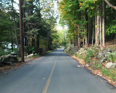
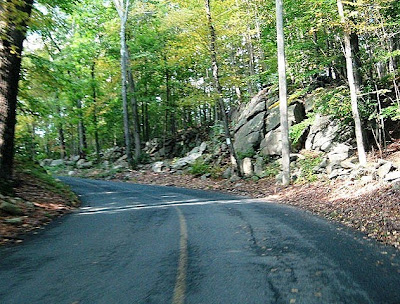
But first, here are a couple photos of trees I passed by on recent bike rides...


The foliage is still not at peak here in Boston ... but we're getting very close.

This past Wednesday, I got up at 5:30 am to watch the announcement of the 2010 Tour de France route on Versus.com (when I told my brother about it, he said, "o.k., it's official now ... you're a die-hard Tour de France fan!"). You can see the route on the Tour de France website. Lots of mountains, windy ocean roads, and even cobblestones!

What was wonderful about the announcement was how Tour Director Christian Prudhomme described the way some towns along the route relate to everyday cycling. Rotterdam, for instance, is where the race will begin. So Prudhomme spoke about how cycling is such a part of daily life in Holland, with so many bike lanes, bicycle commuters, etc. It reminded me that what makes the Tour de France so special is that despite its complicated strategy, it's still just a bunch of cyclists riding on beautiful roads. Anyone who has ever ridden a bike can identify and enjoy.

Monday, October 12, 2009

Autumn on the Minuteman Bikeway

The leaves are really starting to show some color here in Boston. We're not at peak yet -- it takes a little longer for the most spectacular foliage to make its way down from northern New England. But it's beautiful enough. So this morning, I decided to do something special to celebrate the leaves. I rode the Minuteman Bikeway.


The Minuteman Bikeway is an 11-mile path that goes right by where the first battles of the Revolutionary War were fought. It begins at the Alewife T Station in Cambridge (the T is what we call our subway system here in Boston), winds through Arlington, and then heads into the historic town of Lexington before coming to an end in quiet Bedford ... all along what used to be the old Boston-Maine Railroad tracks. The Bikeway is both scenic and practical. Many bicyclists use it to commute into Boston from the western suburbs, locking up their bikes in specially-built bike cages at Alewife Station and then taking the T into the city.

I'd always heard so much about the Bikeway, but getting there involves taking my bike on a 35 minute subway ride from my home on the South Shore. It's not a difficult trip, but just long enough so that I'd never done it.

Fortunately, here in Boston we have a safe and extensive subway system that also officially allows bicycles. So by 7:45 this morning, I was on the Red Line train with my bike beside me, and at 8:25 I was making my way up the Bikeway ... on a chilly 42-degree morning.

The Bikeway is completely flat, with a yellow line down the middle to help ease traffic flow. While it's mainly a bike path, the Minuteman is also used by many runners, walkers, and in-line skaters:


I quickly discovered that riding on a dedicated bikeway is a really delightful experience! Everything seems neighborly and small-scale. It's kind of like cycling through a model train set. Intersections are quaint and friendly...


... and this being a rail-trail, it even passes under an old train station...


The Minuteman Bikeway cuts through green areas between houses, past village centers, and through some beautiful forests. The farther I rode, the more colorful the leaves seemed to become:


It was such a peaceful ride. Before I knew it, I had reached the end in Bedford:


I loved seeing the old railway car, which commemorates Bedford's extensive railroad history. From Bedford, there are so many other incredibly scenic towns to explore ... like Concord, where Thoreau, Emerson, and Alcott all once lived. I rode a little beyond the end of the trail...


But then I decided there would be other days to venture farther west (always save something for another ride ... that's my motto). So I got back on the trail heading the opposite direction...


...and after about 5 miles I turned off the path into Lexington, to take in some of the historic spots on the town green. As you probably already guessed, this is the same Lexington as in "The Battle of Lexington and Concord". It's here on this Battle Green that the first shot of the Revolutionary War was fired (to this day, no one knows by whom):


Two buses stopped by, part of the many New England Fall Foliage motorcoach tours that make their way through this area.


After spending some time on the green, admiring the beauty of the place and thinking about all that happened there, I returned to the Bikeway and pedaled back to Alewife Station in Cambridge. In all, it was a 22-mile trip riding the entire length of the Minuteman and back, taking me past many of the things that make New England so special ... quaint village greens, well-preserved history, and magical foliage.

Wednesday, October 7, 2009

Tour de Aldrich & "Bike Rides" Exhibit

It's 3 pm on Sunday afternoon, and I'm standing in the main exhibit gallery of the Aldrich Contemporary Art Museum. I'm wearing biking shorts, my bright red jacket, cycling shoes, and I have a wicked case of helmet hair. But I fit right in. Most of the people visiting the museum today look just like me.

That's because I just completed the 22 mile "Tour de Aldrich" and I'm now attending the "Bike Rides" Exhibition ... all put on by my new favorite museum: The Aldrich Museum of Contemporary Art!

The Aldrich Contemporary Art Museum is a small gallery in the quiet little town of Ridgefield, Connecticut ... three hours from Boston.


Ridgefiled sits in a beautiful area of rolling hills and historic old villages, right near the New York border. When I read online that the Aldrich Museum was staging a new exhibition dedicated to bicycles, and organizing a bike festival at its opening, and sponsoring three organized bike rides that day, I decided I just had to be there. I drove down on Saturday afternoon with my bike in the back of a large rental car (a Chevy HHR), spent the night at a Marriot Courtyard in nearby Danbury, and then headed to Ridgefield Sunday morning. It was a beautiful day ... sunny, in the mid-70's.

There were three rides to choose from, all leaving at noon from a school near the museum: Novice (13 miles), Intermediate (22 miles), and Advanced (27 miles). I decided on the Intermediate ride, still being new to the group ride experience.

When I registered for the ride on Sunday morning though, I had a few moments of hesitation before officially selecting the 22 mile route. Driving into town, nearly every road I passed had the word "hill" in it! Great Hill Road, Tanton Hill Road, Prospect Hill Road ... what was I getting myself into? And the map handed to me at registration sure seemed to have a lot of squiggly lines on it...


But I reminded myself that I'd ridden farther than 22 miles many times before (although I usually stop every ten minutes to take photos for my blog!). I just needed to conserve energy, rest on the downhills, pace myself, and most important ... just have fun!

The ride was organized by the Aldrich Museum and the Sound Cyclists Club, who did a great job right from the start. I would estimate there were maybe a hundred people or so there.


First we divided into the three groups ... Novice, Intermediate, and Advanced ... each behind our ride leader. Interestingly, our Intermediate group was the smallest (about 15 people), which was kind of nice. The 13-mile Novice group was by far the largest, and the Advanced group had maybe about 35 people.

Before we all left, a lead organizer gave some guidelines for the ride, reminding everyone to follow the standard traffic rules. But he also went over tools for riding effectively as a group ... yelling "car back" when a car was coming up from behind so that we could be sure we were riding single file, telling us how to vocally indicate to other riders when we were passing each other, stopping or slowing down, or pointing out hazards in the road (like "glass!").

Then our 22-mile group leader introduced himself. He was named Herb, a tall man with a nice steel-framed road bike. He reiterated the rules of the road and reminded us of the average speed we would be riding (12-13 mph ... which takes into account going faster than that on the downhill sections and slower going up).

At noon, the main organizer asked the Advance group to head out first, since they would ride at the fastest pace -- and then five minutes later my group was off! I settled in about fourth from the front.

Now, I would have loved to have taken photos during the ride ... but of course that would have been incredibly unsafe. So I kept my camera stored away in my seat bag. But later that afternoon when the ride was over, I went back and drove the entire route by car, stopping wherever I could to take pictures along the way. So the photos you'll see here will look a little empty, but just imagine them with about five or six other cyclists in front!

The ride was beautiful. We made our way down narrow, hilly roads through deep forests and past beautiful homes. In some areas the leaves were still fairly green, but in others the fall colors were really starting to show.


The group got fairly stretched-out early on, which was fine ... we had two "sweepers" (as they called themselves) who were organizers riding within the group to assist or ride with anyone who fell too far behind. But I stayed with or close to the ride leaders from the beginning to the end. It wasn't a race -- I just felt most comfortable riding near the front.

It's amazing how your senses instantly take on a heightened awareness when you begin a group ride. Everything is in motion ... you, the bike, the fluctuating distance between you and the other riders, and of course the scenery. For the first few miles, we passed through narrow roads filled with greenery and farms, cycling up and over a fair number of small hills. The route was well-marked throughout, with signs at every intersection ... and best of all, there were very few cars.


After about 9 miles or so, we stopped for 5 minutes to regroup and then headed out again. This was real rolling countryside now, with beautiful fall foliage ... and one steep hill.


Just before the halfway point, the ride looped back into town through a more densely populated residential area. Again, there were hills throughout, but they were fairly gentle.

By the halfway point itself, I felt great. I was loving the scenery, enjoying the company, and having a smooth ride. Around mile 15 or so, I was riding just behind the leader when we both nearly missed a sharp turn in the route. So we stopped and waited for the others to catch up to warn them.

At that point we then entered into a very affluent part of town, with huge mansions and tree-lined streets. It was beautiful. Golf Lane had some of the steepest hills of the ride ... but the downhills afterwards were wonderful, so there were plenty of chances to recover. At around mile 19, we took a quick moment to regroup one last time, and then off we went for the final stretch.

We all truly rode at our own pace at this point, and I was still feeling very good ... zipping down the road behind the two leading riders. But little did I know that the last two miles would be the hilliest of all!

Knowing the end was near though, I kept pressing forward ... up and over the hills on a road that weaved through some beautiful forest scenery -- until finally we were on Main Street! Just ahead lay the Aldrich Contemporary Art Museum and the end of our ride.

Riding down Main Street and then turning into the Aldrich sure was a wonderful feeling.


A volunteer congratulated me at the Aldrich's entrance and welcomed me to the "Bike Fest" -- which by this time (2 pm) was already in full swing.


Getting off my bike, I chatted with some of the other riders and the ride leaders. We had talked a little during the ride ... but not much. We were mainly intent on simply cycling. So it was nice to stand and get to know each other for a bit. One woman had just returned from a cycling trip through Italy (for fun, I signed up to receive the tour company's catalog when I got home).

There were bicycles everywhere at the Bike Fest, which took place in the museum's parking lot. Some were locked up, but most were not (small-town life sure is different than the city). I rolled my bike into the festival area, stopped by some of the sponsor booths, and watched a bit of a stunt rider doing tricks. I was then going to find a place to lean my bike so that I could check out the exhibit inside; but not having a bike lock with me, I decided I would ride to my car, put my bike in the back, and then drive back to the museum. Being a subway-riding-city-person, it's just not in my nature to leave my bike outside unlocked, no matter how safe it seemed!

So I rode the short distance to the school where two hours earlier I had embarked on the 22-mile ride. I put my bike in the back of the car...


...drove to a parking lot across the street from the museum, and returned to the exhibit...


As someone who loves modern art and cycling, experiencing both combined was an incredible thing! The museum had two of Lance Armstrong's beautifully painted Trek bikes, as well as bicycles enhanced by contemporary artists, video art on bike themes, and commercially produced bikes that truly did look like works of art (Cannondales, Sevens, Parlees, and other brands).

Here's a PDF of the online catalog from the museum's website.

After spending about an hour or so at the exhibition, I drove the entire 22-mile tour route by car to take photos (while listening to the end of the Patriots game on the radio), stopped in a Dunkin' Donuts to change into non-cycling clothes and buy an iced-coffee, and then hopped on I-84 to begin the three-hour drive home. The trip flew by, with so many great memories of this exciting and inspiring day to keep me company.

So a big thank you to all the folks at the Aldrich Contemporary Art Museum, Sound Cyclists, and the volunteers for creating such a fantastic event!